|
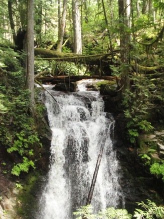
Roberts Creek WaterfallWho knew that Roberts Creek had a really pretty waterfall just a short 1/2 kilometre hike from the end of Day Road! Well...someone probably knew, but I didn't. I stumbled upon the Roberts Creek waterfall when I was hiking and gpsing the trails around Day Road up to Branch 04 of the Roberts Flume Forest Service Road. This is, in my opinion, the prettiest falls I've come across on the Sunshine Coast - better than Langdale and Chapman for sure. Because of the short hike and easy access, it is also the easiest falls to get to. Most of my hiking and biking routes are a minimum of 1 to 3 hours, but this is a short 15 minutes if you take the Day Rd. route below.
The Roberts Creek waterfall actually has two parts, but the best view is of the top section. If you are agile and don't mind steep slopes you can make your way right down to the bottom of this part of the falls. There is a rocky area and shallow pool at the base here and then the creek carries on for a short distance and drops down again for the second tier of the falls. I imagine it is a popular spot on a hot summer day.
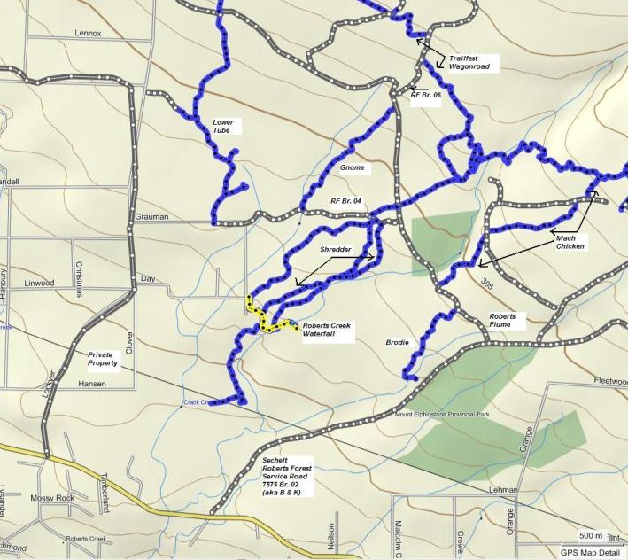
If you check out the map you can see that there are other ways to access Roberts Creek waterfall if you want a little more of a hike. I liked parking my car up on Branch 04 of the Roberts Flume Forest Service Road and then hiking down the first part of Shredder and then taking the first left down to the trailhead for the falls. This is probably about 1.5 kilometres each way.
Click here to return from the Roberts Creek Waterfall to the Bikes & Hikes page.
|


