BLT, Chapman Falls and Selma Park Hiking and Biking Route
BLT is a new trail built last fall which means it's nice and soft for hiking and biking. Not too difficult for riding either as it isn't very technical and doesn't have any technical features. Only thing to make it a bit of a challenge is the climb (as usual). Hiking time if you go all the way out to Dusty Rd. and back again is about 2 to 2 1/2 hours.
It can be accessed either from Dusty Rd. in Porpoise Bay (the road up to the Sechelt landfill) or from the Chapman Creek Falls trail. If you want to access from Porpoise Bay: - Head towards Sandy Hook and right where Sechelt Inlet Road changes from two to one lane, turn right up Dusty Rd.
- Follow the road up past the Landfill and onto the gravel road. Just past the landfill you will see a road off to the right with a bright yellow gate.
- Park here and head down this road about 1/2 km. Keep to the left as there is a road off to the right.
- At the top of the hill on your right you'll see the single track trail that is signed BLT.
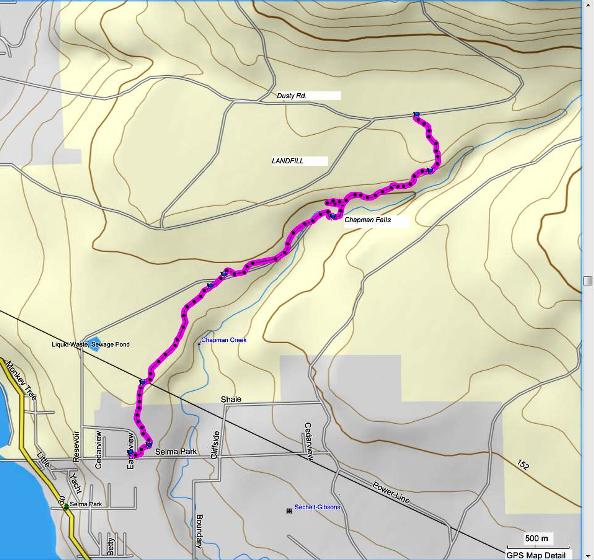
My map shows the route from the top of Selma Park Rd. to BLT.
The image below is actually interactive. It is a Google Earth gadget that embeds the image of the trail route that you can zoom in and out of with the zoom bar on the right. You can also use the slider bar to back up through the route. It's pretty cool. Oh, you can close the bubble to get it out of your way if you like.

The Mapsource map above is a little out of whack because it shows the trail entering part way along Selma Park Rd. In actual fact, the road ends and the trail begins that takes you into the Chapman Creek trail. Chapman Creek Falls is to the left and lower Chapman Creek all the way to Brookman Park is to the right. This appears to be a flaw in the Mapsource map. The Google Earth map above this one shows the trail accurately entering at the top of Selma Park Rd.
- Head up Selma Park Rd. to the very top and park.
- Go straight into the bush from the end of the road and you'll see the trail that enters here.
- Follow this trail pretty much straight in for about 1/4 km until you see the main trail. Turn left here.
- Keep on this trail until you come out to the power lines and go under and back into the trail on the other side.
- Stay on this trail. You'll pass a couple of abandoned old vehicles and the trail comes out to a wider trail/road that takes you past a pump house (I think).
- Last time I was there there were a couple of wooden barricades that you pass through. Follow this road along until you get to the falls.
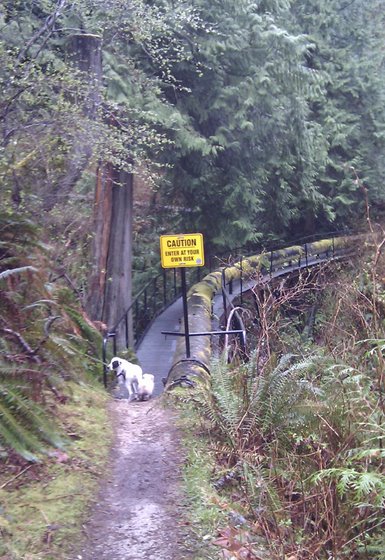
- You will see the falls before the trail ends. Keep going and pass over two metal grated walkways/bridges that are about a metre wide.
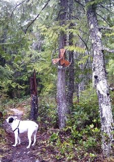
- Just past the bridges you'll see a trail on your left that has a propeller-type sign that says BLT.

Click here to return from BLT to the Bikes & Hikes page.
Click here to return from BLT to the Sunshine Coast Trails Home page.
Enjoy this page? Would you like to link to it? Here's how:
Would you prefer to share this page with others by linking to it?
- Click on the HTML link code below.
- Copy and paste it, adding a note of your own, into your blog, a Web page, forums, a blog comment,
your Facebook account, or anywhere that someone would find this page valuable.
|


