[?]Subscribe To This Site and Get Updated Trail Information


|
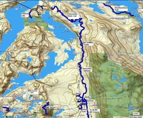
Pender Harbour Trail MapPender Harbour (including Egmont) is the northern most point of the lower Sunshine Coast. This area probably has the least amount of hiking and biking trails on the Coast, but is full of beautiful, crystal clear lakes. Fantastic recreational area and perfect for a day of hiking or biking and then a dip in one of the local lakes.
Access to this area is simple:
Click here to open pdf version of this map with higher resolution.
Click here to return to the Pender Harbour trail descriptions.
|