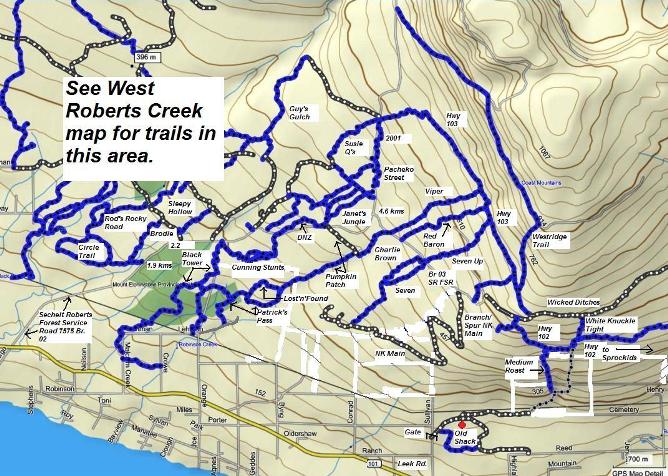
Roberts Creek East Map
Click on a trail in the Roberts Creek East map below to see details.
Note: The blue tracks are trails, the dark gray tracks are logging road spurs and the light gray track is a dirt road.
Click here to download a larger, pdf version of the map below.
New! Comments
I began this site as a labour of love and in response to what I believed was a need to have one comprehensive website with detailed information about all trails on the Sunshine Coast.So here it is several months later and I've had so much fun hiking, biking and gpsing nearly every trail on the Sunshine Coast. Along the way the site has gained some loyal followers and we would love to know your thoughts about this page, site and/or the Sunshine Coast...
So if you have a moment (and a Facebook account OR Yahoo, AOL, Hotmail) please leave a comment in the box below.