|
Chapman Wilson Creeks Trails (Pell Road Area)Chapman and Wilson Creeks are located between Roberts Creek and Sechelt. Chapman Creek is a spawning area for Coho, Pink and Chum Salmon. Just up the creek a ways is the Chapman Creek Fish Hatchery which is open year round. This hatchery is responsible for providing breeding stock like Coho, Chum, Pink, Sockeye and Cutthroat Trout.
Chapman Creek trail starts at Brookman Park which is just at the bridge on Hwy. 101 on the boundary between Wilson Creek and Davis Bay. The park itself is an off-leash park, but is very close to the highway so if your dog might run off you will not want to let them off the leash here. Access to this trail is best here at Brookman Park or from the top of Selma Park Rd. If you start at Brookman and follow the trail along the creek, you will eventually come to the end where you will need to climb up a very steep embankment to continue on the trail. This is not an easy climb and it is quite scary just as you get to the top and a very long way down. Use extreme caution here! Other than the steep embankment here, the rest of the trail from this point on is very easy hiking and biking. Up Field Road is access into a wilderness area where you will find the trails Blue 14, Dirty Pickle, and Honey Bee. These trails are considered to be Intermediate or More Difficult riding level. Pretty easy for hiking though. If you take the main Sechelt Roberts Forest Service Road for several kilometres and follow the signs for Dakota Ridge you will also be able to access the main Roberts Creek trails. The trails located in the Wilson Creek area are often referred to as the Pell Road trails. There are many trails here and most can be accessed either from Pell Road itself or also from the forest service road that joins the end of Lockyer Road. For information on logging in the Mount Elphinstone area check out this great website.
Below is a list of the trails that have names. Please keep in mind that most of these trails would be hiked or ridden in combination with others and don't generally stand alone. Most of these trails are either Intermediate or Easy difficulty for riding and other than hills, easy hiking. Click on the link to go to the trail map for the area. SqueezerTrail Rating for Bikers: More Difficult (Intermediate) One of the highest trails in Roberts Creek, this intermediate trail is short and sweet. Connects up to a logging road. 1st StepTrail Rating for Bikers: More Difficult (Intermediate) 1st Step is the highest of the steps. (2nd Step has been logged out and hasn't been rebuilt to the best of my knowledge - as of June 2011). 1st Step connects up to the Roberts Flume Branch Forest Service Road and is a good way to access the Roberts Creek trails. It is a pretty steep climb, but a fun ride down. If ridden in combination with Ripped Nipple you could easily connect into the Trailfest Wagonroad trail and then down Upper and Lower Tube which are excellent, fast downhill trails in the Roberts Creek area. 3rd StepTrail Rating for Bikers: More Difficult (Intermediate) 3rd Step is usually best accessed from the trail at Jack Rd. The area has recently been logged (2011). This is a single track trail that connects between two logging road spurs. Jack Rd. TrailTrail Rating for Bikers: More Difficult (Intermediate) This trail is accessed across the highway from Jack Rd. It is a wide, wet trail that takes you up to a recently logged area (2011). Brings you into close proximity of 3rd Step. Chapman Creek Trail (Falls)Trail Rating for Bikers: Easy (Beginner) This trail is a for someone who loves a bike ride, but doesn't want anything too challenging. Also makes for a pretty easy hike, but if you decide to hike all the way to the falls, it will likely take you 1.5 to 2 hours there and back. Probably about an hour ride. Best place to access the trail is from the end of Selma Park Road. At that point you can go straight into the trail and go left to head for the falls and right to head towards Wilson Creek. If you enter at Brookman Park and follow the trail along the creek to the end, there is a very steep embankment to climb up that is quite steep and dangerous. Use extreme caution here. I would not take a bike this way as it would be extremely difficult to make this climb with a bike and very dangerous. Blue 14 (Bridge Out)Trail Rating for Bikers: Easy (Beginner) Blue 14 is the highest trail in this area and is a pretty easy trail for riding and hiking and is quite pretty. Lots of tree cover and it follows alongside the creek (high above it) so it would be a nice, cool place in the summer. One section of the trail runs alongside a clay cliff and I suspect it would be very slippery when wet. This trail used to have a bridge that crossed Chapman creek and continued out to a forest service road above the Porpoise Bay area, above the Landfill a few kilometres. Unfortunately, this bridge fell into disrepair and it is now impossible to cross here. By this time next year, there should be a new bridge that crosses the creek, likely above the Selma Park Road area. You would likely want to ride this trail in combination with Dirty Pickle. Dirty PickleTrail Rating for Bikers: More Difficult (Intermediate) Dirty Pickle is a more difficult trail because it is narrow with lots of loose rock and if you are going up it, you will find the going tough as it is quite steep. When you come out at the top onto a logging road, you can go left and down a short trail that will take you straight to Blue 14 at a small creek. This short connecting trail is very steep and difficult with large, loose rocks. Actually it looks like a creek bed it's so rough. Honey BeeTrail Rating for Bikers: More Difficult (Intermediate) The trail head for Honey Bee is approx. 3.1 kilometres up the Sechelt Roberts Forest Service Road Br. 02. This road is the access to Dakota Ridge and if you stay on this branch it will eventually take you over to Roberts Creek and back out to the highway just southeast of Cliff Gilker Park. Honey Bee goes straight in off the logging road (do not take the road/trail that cuts down and parallel to the road). It starts out wide and then narrows to a trail. When you come to a hill with loose wood look for the trail to your left. Don't head up the hill. The trail continues widening and narrowing and eventually brings you out to another logging road spur. At this point turn left. The road to your right dead ends. If you turn right when you come out to the next road you will pass through a gate and go to the end of this road to access Dirty Pickle and Blue 14. Dave's BypassTrail Rating for Bikers: More Difficult (Intermediate) This is actually an atv trail, but of course can be ridden and hiked as well. There is a very wet, muddy spot to get through, but otherwise it is a pretty easy track. It goes right through Wilson Creek which is fine if you are driving an atv, however there are a couple of short trails that connect you to the Logger Sports trail which does have a bridge. Logger SportsTrail Rating for Bikers: More Difficult (Intermediate) This trail is accessed off of a logging road spur that forks off of the main logging road. It is the second road on the right past the private property (Cloutier's). It is quite a climb up the spur road, but once on the trail it undulates down to Wilson Creek where there is a bridge. Once across the bridge it is a short way up onto another logging road that takes you into the Roberts Creek trail network. New Trail from Airport to New BridgeTrail Rating for Bikers: Easy (Beginner) This is a great new trail that was built to connect to the new bridge over Chapman Creek and into the Chapman Creek trail network. It is wide and fairly smooth with some hill. Suitable for all riders and in dry weather I think it would be wheelchair accessible (a bit of a push up the hills though). Wet weather I think some areas would be muddy and too difficult for wheelchairs. Ripped NippleTrail Rating for Bikers: More Difficult (Intermediate) Ripped Nipple, as mentioned above, is a short connecting trail between 1st Step and some of the western Roberts Creek trails. It is a steep, single track trail.
Click here to return from Chapman Wilson Creeks Trails to the Sunshine Coast Trails Home page. |

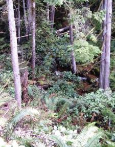
Looking down on a stream on the 2nd Step.


