Mount Daniel Hike
Facebook fans voted this "Most Romantic" trail on the lower Sunshine Coast
The views from Mount Daniel are to die for and well worth the climb. This small mountain is approx. 440 metres (1443 feet) high and takes about 40 minutes to an hour to climb depending on your fitness level (obviously). The distance covered is approx. 3 km each way.
Mount Daniel is also a very special place according to local First Nations' history. There are two legends regarding this mountain. The first is that it was used as a lookout for any threats coming to the village by water or land.
The second is that it was used by the local First Nations' young women to celebrate their "rite of passage" at puberty. Regardless of what the truth is, it is a protected archeological site and you should not disturb or take away anything from the summit.
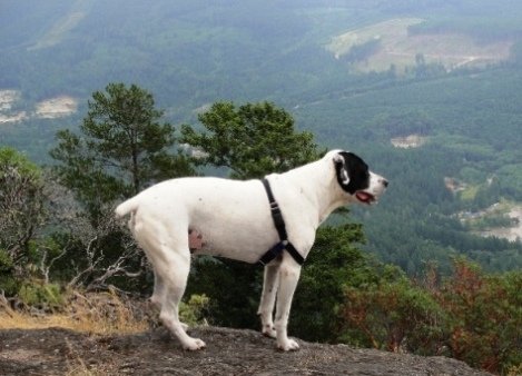
 My dog Nick surveying the kingdom of Pender Harbour. You can see a clear cut in the distance and the trail Highway to Hell which is up near the treeline above the logging road.
Here's how to get here:
- Take Hwy. 101 to Garden Bay Road and turn onto it (you can only turn one way).
- Follow Garden Bay Road approximately 3.5 kms, just left past the Oyster Bay Road. I parked right off the road, but you can go up the road a short distance and park as well.
The image below is interactive. It's a Google Earth gadget that embeds the image of the trail route. You can zoom in and out of it with the zoom bar on the right. You can also use the slider bar to move through the route. It's pretty cool.
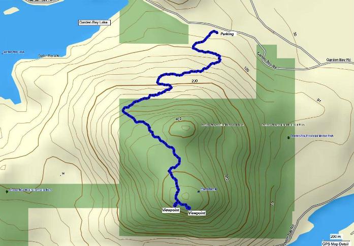
Here's the same map, viewed using Mapsource.

This hike doesn't require much direction as there is only the one trail and it is well marked. However, here's the little bit I can tell you:
- If you park at the road like I did, just head up the gravel road and keep to the left at the fork.
- At the end of the gravel road you will see a sign indicating you are at the trail head.
- The trail climbs pretty relentlessly to the top with few opportunities for respite unless you stop and rest.
- Near the top you will pop out into what looks like it might be the summit, but it's not :-)
- The summit is about another 5 minutes and the trail heads off to the left at this point, down a bit and then up the last hill.
- When you get to the top, you can explore a bit to get different views and enjoy a much deserved rest or picnic. Just be sure to tote out what you take in.
Once you get back down, if you still need more exercise and more views, you can make your way down the road a little way and hike up Pender Hill. It is short (only about .75 kms each way), not as high (220 metres) and will give you a different perspective and more beautiful views.
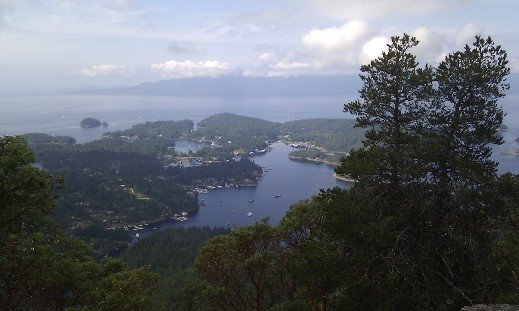
 One of the views from the top of Mt. Daniel.
Click here to return from Mount Daniel to the Hiking and Biking page.
Click here to return from Mount Daniel to the Sunshine Coast Trails Home page.
New! Comments
I began this site as a labour of love and in response to what I believed was a need to have one comprehensive website with detailed information about all trails on the Sunshine Coast.So here it is several months later and I've had so much fun hiking, biking and gpsing nearly every trail on the Sunshine Coast. Along the way the site has gained some loyal followers and we would love to know your thoughts about this page, site and/or the Sunshine Coast...
So if you have a moment (and a Facebook account OR Yahoo, AOL, Hotmail) please leave a comment in the box below.