Rocky Mountain Luge Hiking & Biking Route
Note: As of summer 2014 Rocky Mountain Luge is no longer being maintained for riders!
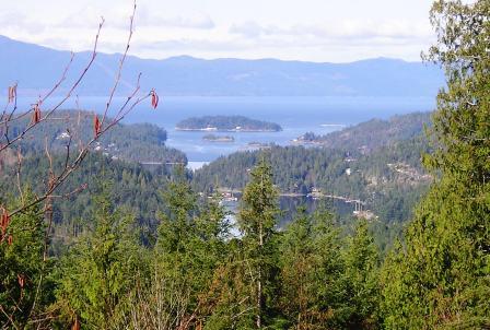
Rocky Mountain Luge is a challenging trail for bikers and hikers located in the Madeira Park area. It is perfectly situated for downhill riders if you don't mind a lot of driving as you could shuttle riders to the top of the trail and leave a vehicle at the bottom of the trail. However, you'd probably have a total driving time, back and forth, of a couple hours. Plus the Halfmoon Carlson Forest Service Road that you travel up to get to the top of Rocky Mountain Luge would be best driven in a 4X4 as it is rough.
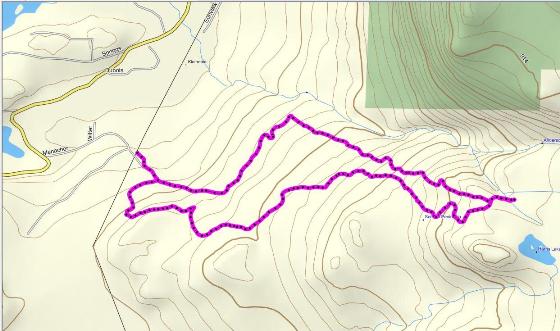
Because of the snow above 2300 ft, I've only shown part of the trail and GPS'd it as a loop. Elevation at the start is around 350 ft. and at the highest point approximately 2300 - so almost a 2000 ft. climb. Once the snow melts and the trail can be hiked all the way out to the Halfmoon Carlson Forest Service Rd. the elevation peaks at over 3000 ft. That makes the elevation gain very close to that of the Grouse Grind, but over a longer distance. The Grouse Grind climbs about 853 metres (2800 ft.) over 2.9 kms (1.8 miles) and to the top and back of Rocky Mountain Luge the distance is about 10 kms. This is a fantastic workout and shouldn't be attempted unless you are in good condition.

The image below is actually interactive. It is a Google Earth gadget that embeds the image of the trail route that you can zoom in and out of with the zoom bar on the right. You can also use the slider bar to back up through the route. It's pretty cool. Oh, you can close the bubble to get it out of your way if you like.

Same route using Mapsource map
To get here:
- Head up Coast via Highway 101 past Madeira Park Rd.
- Travel 4.2 kms from here to Menacher Rd. and turn right.
- Follow Menacher Rd. up to the next gravel road on your left. There is a sign here that says "Trail Rides". I park here as my car doesn't do well on rough roads. However you could travel further up this logging road if you have a vehicle that can manage it.

- Whether on foot or in your vehicle, you want to follow this logging road uphill to the first road that goes off to the right. (If you are still if your vehicle, park it here before going any further.)
- Turn right on the road and go up to the end (don't take the road that goes off to the left)and into the trail to the left. As you've headed up this road you should be able to see the trail cutting across the clearcut.
- The trail skirts around the hill and comes out onto another logging road. Turn right here.
- You are going to stay on this logging road for a couple kilometres. It goes from gravel wide road, to wide dirt/rocky road to wide dirt 4X4 only road.
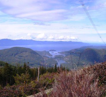
- When you come out to the powerlines you are going to go left and follow the powerline road. This road covers some very steep and rocky terrain.
- After a couple kilometres you will come to a trail that cuts into the trees on the left. It is signed and is called AC Canyon.
- Follow the trail until it comes out to a road (about 1/2 km).
- Turn right on the road and follow it down til it comes out to a main logging road.
- Turn right and follow this road back down to your vehicle.
Click here to return from Rocky Mountain Luge to the Bikes & Hikes page.
Click here to return from Rocky Mountain Luge to the Sunshine Coast Trails Home page.
Enjoy this page? Would you like to link to it? Here's how:
Would you prefer to share this page with others by linking to it?
- Click on the HTML link code below.
- Copy and paste it, adding a note of your own, into your blog, a Web page, forums, a blog comment,
your Facebook account, or anywhere that someone would find this page valuable.
|


